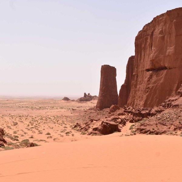
dedicated to the memory of Dr. Cheikh Achrati, this post is part 5 of a series covering travels in Algeria In 2019 I went on a pilgrimage of sorts from El Bayadh to visit Aïn Sefra in western Algeria. The day trip was arranged to offer detours through the Ksour Mountains, rock art carvings, and... Continue Reading →
The Cliffs of El Gour
this post is part 4 of a series covering my trip to Algeria this past February South of Brezina, in the Algerian province of El Bayadh, lies a series of mesas marking the start of the Sahara. I've visited the area on three occasions, the first of which was during a sandstorm in December 2017.... Continue Reading →
The Road to Brezina
this post is part 3 of a series covering my trip to Algeria this past February These photographs from Algeria show the geography and geology of the Saharan Atlas mountains between El Bayadh and Brezina, a small oasis marking the start of the desert. All photos taken by the author, from the front seat of... Continue Reading →
El Bayadh – the city and its green belt
this post is part 2 of a series covering my trip to Algeria this past February The previous post reviewed photographs taken from a flight from Algiers to El Bayadh in February, comparing the bird's eye view from the plane to the God's eye view of satellite imagery. As the flight approached El Bayadh we... Continue Reading →
Algerie – Vue du Ciel
part 1 of a series covering my trip to Algeria this past February The documentary L'Algerie Vue du Ciel is a beautiful portrait of Algeria with slow motion sweeping panoramas of many cities and regions. The ever present voice-over commentary keep the feeling closer to a travelogue or nature documentary than an experimental documentary like... Continue Reading →
NYC Neighborhood Mapping
Last week's post on the NYC lampshade showed not-quite-finished work, but work that had been refined and recreated in a long process of sketching and tracing while exploring typography and legibility. I wanted to share the process tracings, to show the different aesthetic directions driven by handwriting choices. It felt freeing to draw and explore... Continue Reading →
NYC Lampshade
As part of a series of maps and sketches of neighborhood names and boundaries, I have started to make lampshades to hang from pendant light fixtures. The shades are made of trace (in the example below the trace is sandwiched around simple printer paper) held in shape with an embroidery hoop on either end of... Continue Reading →
LeFrak Center – Mapping Movement
Last weekend I took a walk through Prospect Park and meandered to the LeFrak Center, the ice rink completed in 2014 by TWBTA. I enjoyed a tour of the grounds guided by the project manager Andy Kim as part of Open House New York back in 2018. One of the most striking elements of the... Continue Reading →
05/04: Crowdsourcing the Image of the City
This post is part of a few others on mapping and neighborhood identity. Another look at Kevin Lynch's The Image of the City, today focusing on the research methodology and the maps derived from this research. Lynch and his team sought out 30 people (admittedly mostly professional and definitely not a random sample of citizens)... Continue Reading →
04/24: Defining Belmont
In West Philadelphia the Belmont neighborhood is defined by Lancaster Ave to the south, 40th St to the east, Belmont Ave to the west and the Septa tracks to the north. These four borders give definition to a place and a neighborhood. Depending on who you ask, this area could be considered part of Mantua, and... Continue Reading →