
Two days until final presentations, so another brief post today about The Greater Philadelphia Geohistory Network and their overlays of historic maps of Philadelphia. The interface allows you to browse around a map or satellite view of Philadelphia via Google Maps. Users have the ability to add layers of maps, for instance the 1962 Land Use map from the Works Progress Administration or the 1895 Philadelphia Atlas by G.W. Bromley. Below is a look at how the Belmont neighborhood of Philadelphia has changed from 1808 to today:

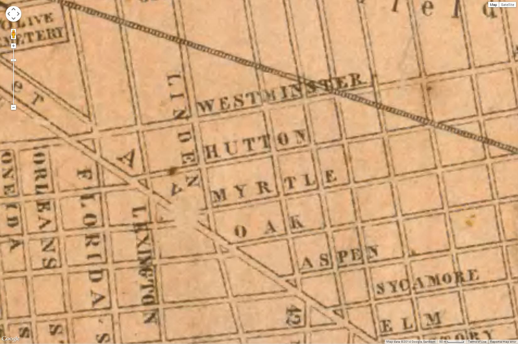


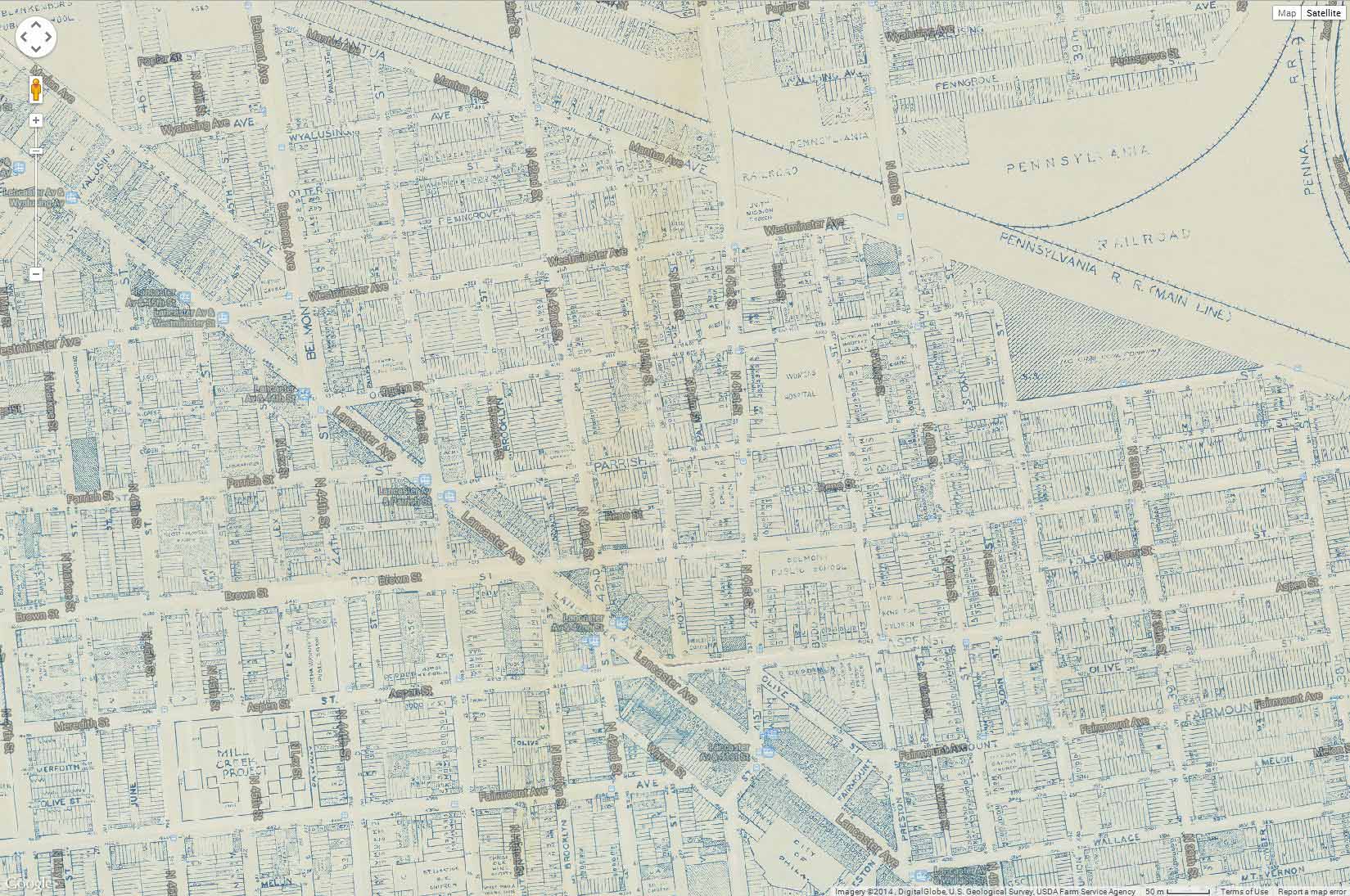
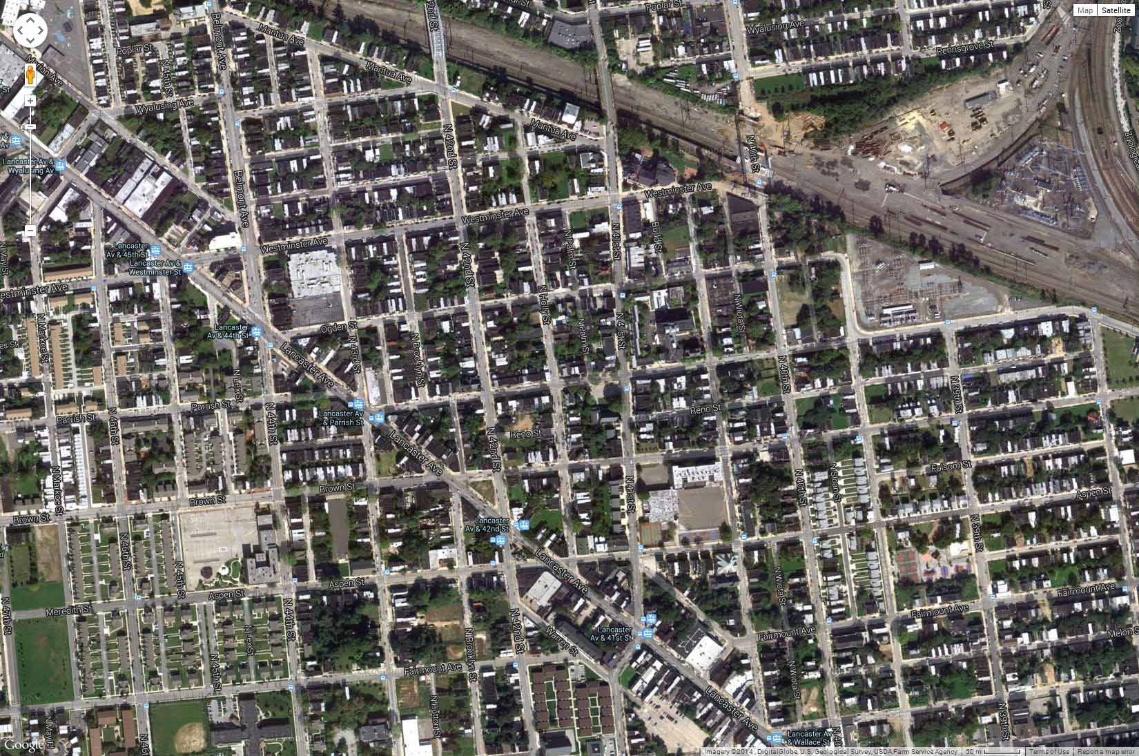
(All images from philageohistory.org)

Leave a comment