
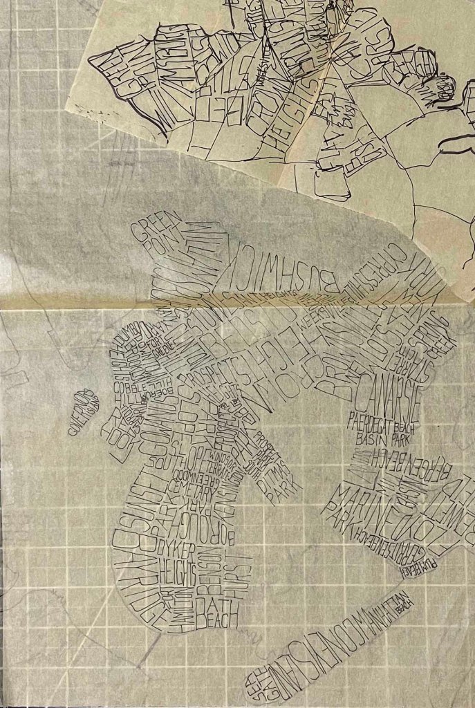
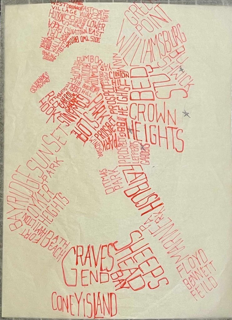
Last week’s post on the NYC lampshade showed not-quite-finished work, but work that had been refined and recreated in a long process of sketching and tracing while exploring typography and legibility. I wanted to share the process tracings, to show the different aesthetic directions driven by handwriting choices. It felt freeing to draw and explore what was and is a very intuitive process. I could draw this map over and over and would end up with something different each time.
What is not documented here is the process of researching neighborhood names, because that effort was mostly done with a handful of Google Image searches. More complicated (and interesting) would be to crowd source the names of neighborhoods and their boundaries. The maps found online cater to tourism and NYC as a brand, and they often focus on older, wealthier and whiter parts of the city. Some neighborhoods span a few blocks, and others cover hundreds of acres, likely conflating a number of distinct neighborhoods. I felt obliged to make sure every city block had a label, but some industrial areas lack a real identity or name. Some locations could claim to be a part of two or three neighborhoods. This was not so much an exercise in accuracy as it was in repetition and iteration.


Two follow up thoughts. First, I’d like to see an animation showing this geography and the place names as they change over time, from Manahatta to New Amsterdam to the present day. Secondly (and unrelated) I’d be curious if AI can already automate most if not all of this map making exercise.

I’ve enjoyed reading this, but have never been able to comment since I wasn’t a member. Or so I thought! But read the intructions. Haha
Love, Aunt Gina