
part 1 of a series covering my trip to Algeria this past February
The documentary L’Algerie Vue du Ciel is a beautiful portrait of Algeria with slow motion sweeping panoramas of many cities and regions. The ever present voice-over commentary keep the feeling closer to a travelogue or nature documentary than an experimental documentary like Koyaanisqatsi. There is a strange and voyeuristic quality to much of the footage, but this effect is largely diffused by the final montage/goodbye at the end of the film. In 2017 I watched the french version of the film. This past January I found an english version of the film and watched it in anticipation of my visit to Algeria.
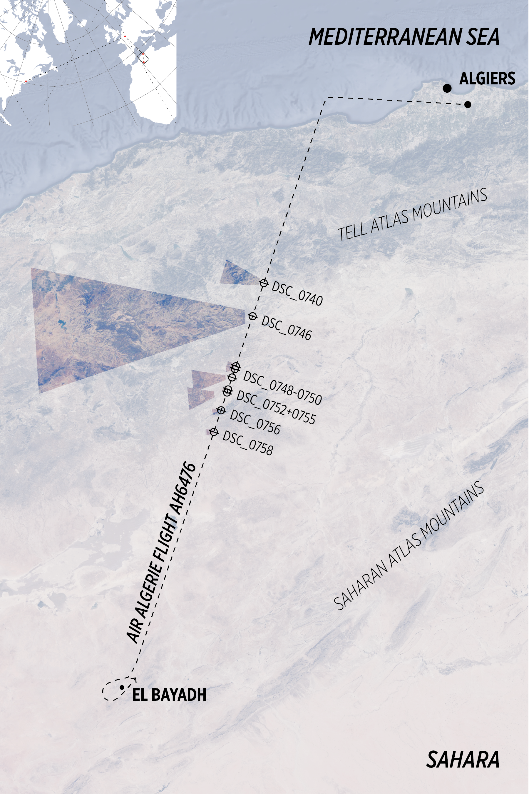
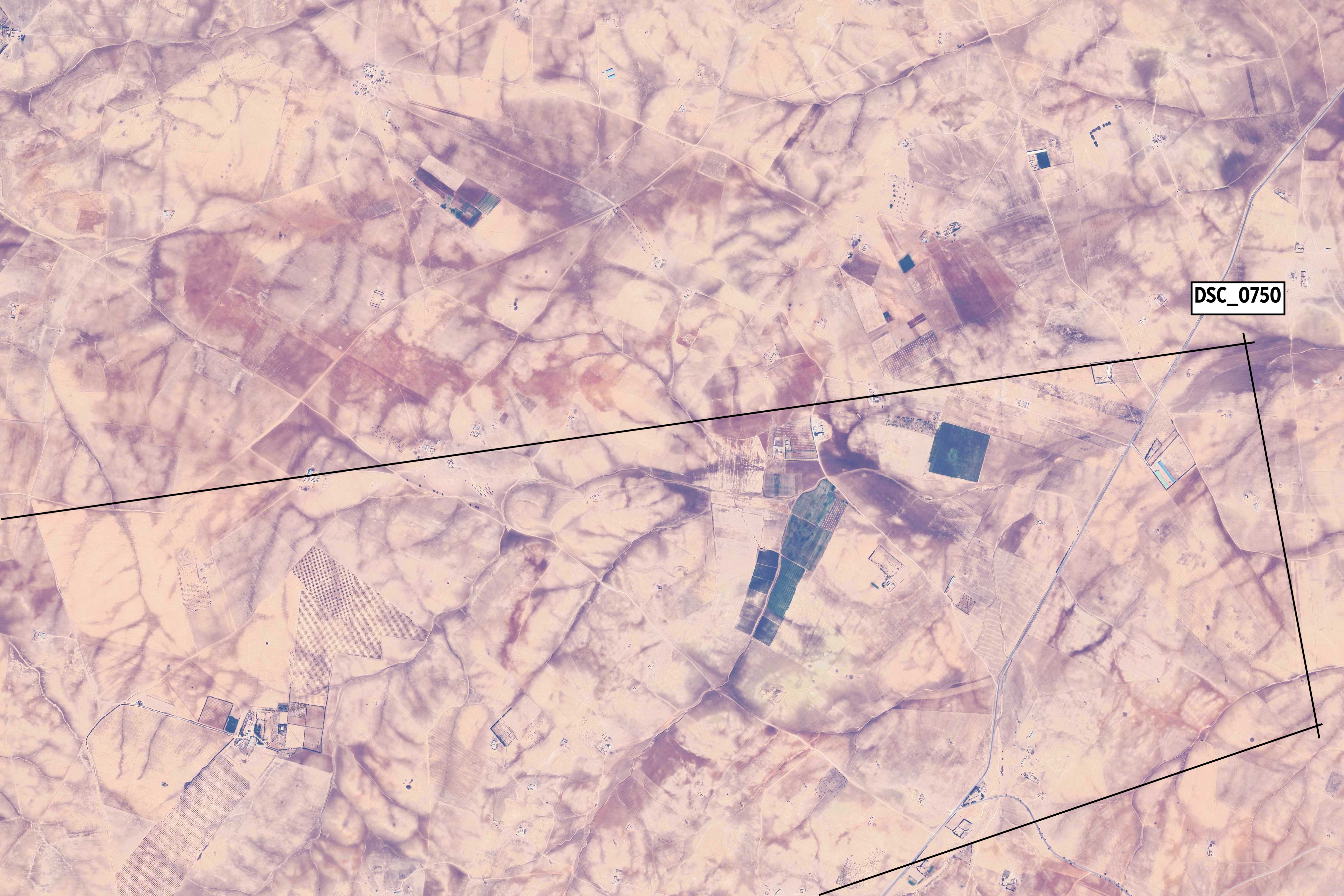
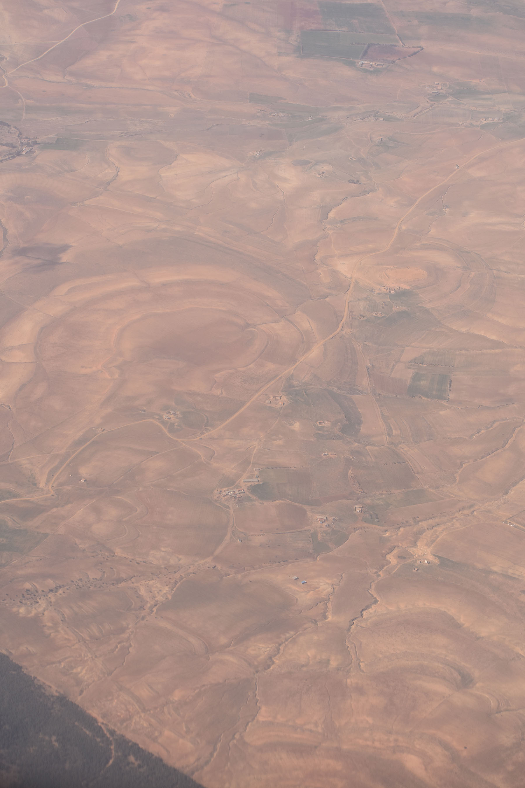
I am in the process of documenting my February trip to Algeria and am starting with a few images captured during an hour long flight from Algiers to El Bayadh, located just north of the Saharan Atlas mountains. The photos are of both natural and man-made features and settlements. I can estimate the flight path taken by locating certain areas on satellite images. The departure from Algiers and brief foray over the Mediterranean were both sunny, but much of the first half of the flight was overcast. By the time we reached the southern band of the Tell Atlas range the skies cleared.
There is a rich history of designers and architects seeking to explore the ground from the air. The legacy and impact that flight had on modern architecture is explored in depth in Impossible Heights: Skyscrapers, Flight, and the Master Builder (Dr. Adnan Morshed). The book focuses on three figures of the early 20th Century in Hugh Ferriss, Buckminster Fuller, and Norman Bel Geddes, exploring the relationship between the development of flight and of the skyscraper. From the introduction: Aerial photographs of cities and landscapes – accompanying magazine articles with such alluring titles as “Aeronautics Will Develop a Broader Vistion,” “A bit of Philosophy on Flying,” and “Seeing Things from Above” — often fused the airplane view with a Promethean seer to whom the Earth promised full disclosure.
Le Corbusier wrote an entire Aircraft1 book (first published in english in 1935) on the subject of flight and the radical beauty found in airplane design as a response to gravity and air pressure. He includes an account of a flight from Algiers to Ghardaia in the book. For a more contemporary review of Corbusier and his Ghardaia trip, see the essay The Algerian Sphinx2 by Álvaro Velasco Pérez. For a connection between Corbusier, aircraft and climate change, see this article from Lloyd Alter’s Carbon Upfront! Substack.

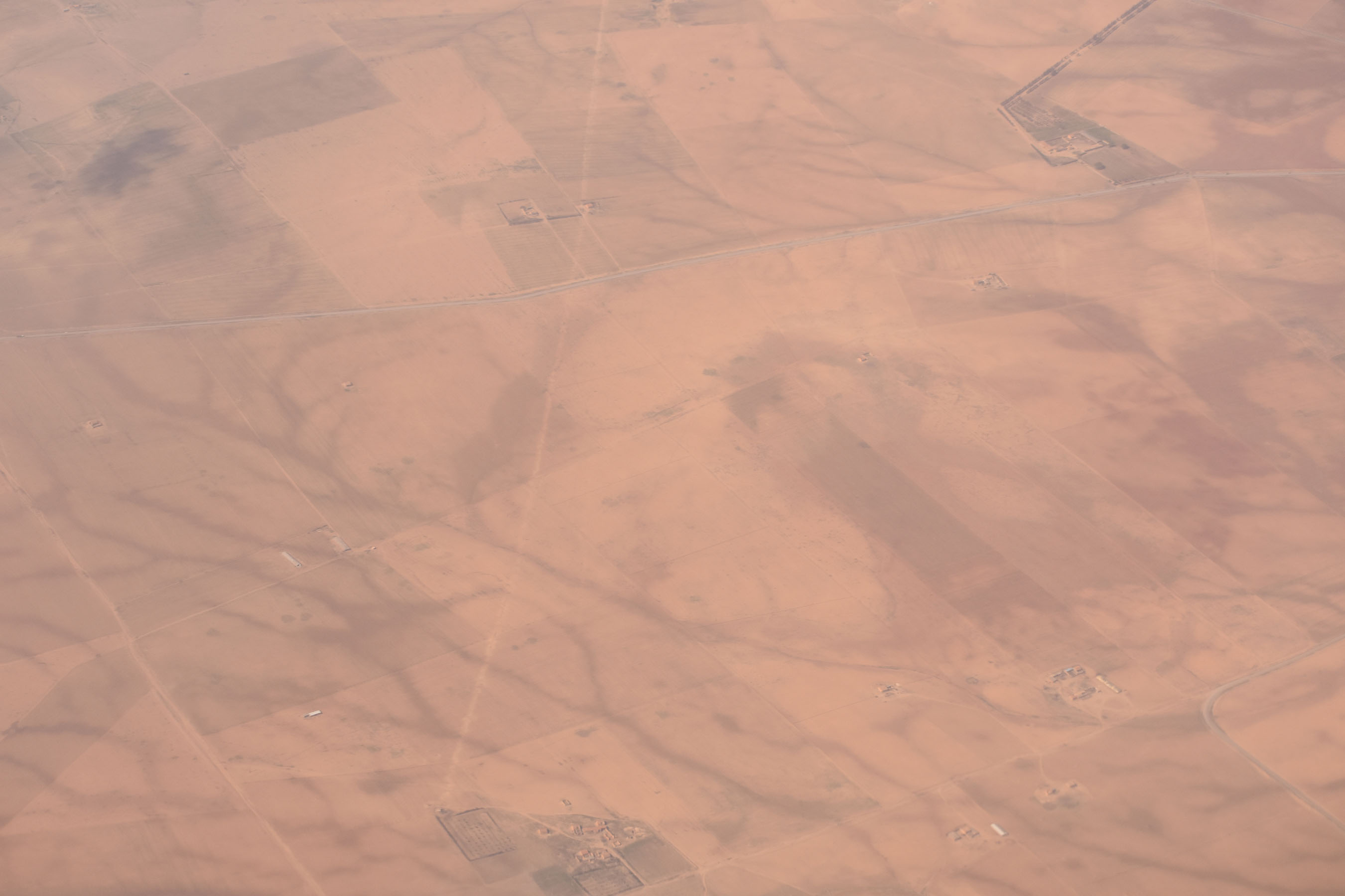
On the Air Algerie flight, the clouds parted in time to see the start of the plateau between the Tell and Saharan Atlas mountain ranges. Both the satellite imagery and the photographs taken from the plane ride show the beige hues of dry plains scarred by the vascular patterns of wadis and dry creek beds – tributaries possibly still wet from recent rains.

In 1996 the landscape architect James Corner and photographer Alex McLean published Taking Measures Across the American Landscape, a collection of essays and photographs of the American landscape. I am still tracking down a copy of this book, but have written about Corner and his Agency of Mapping previously on this site.


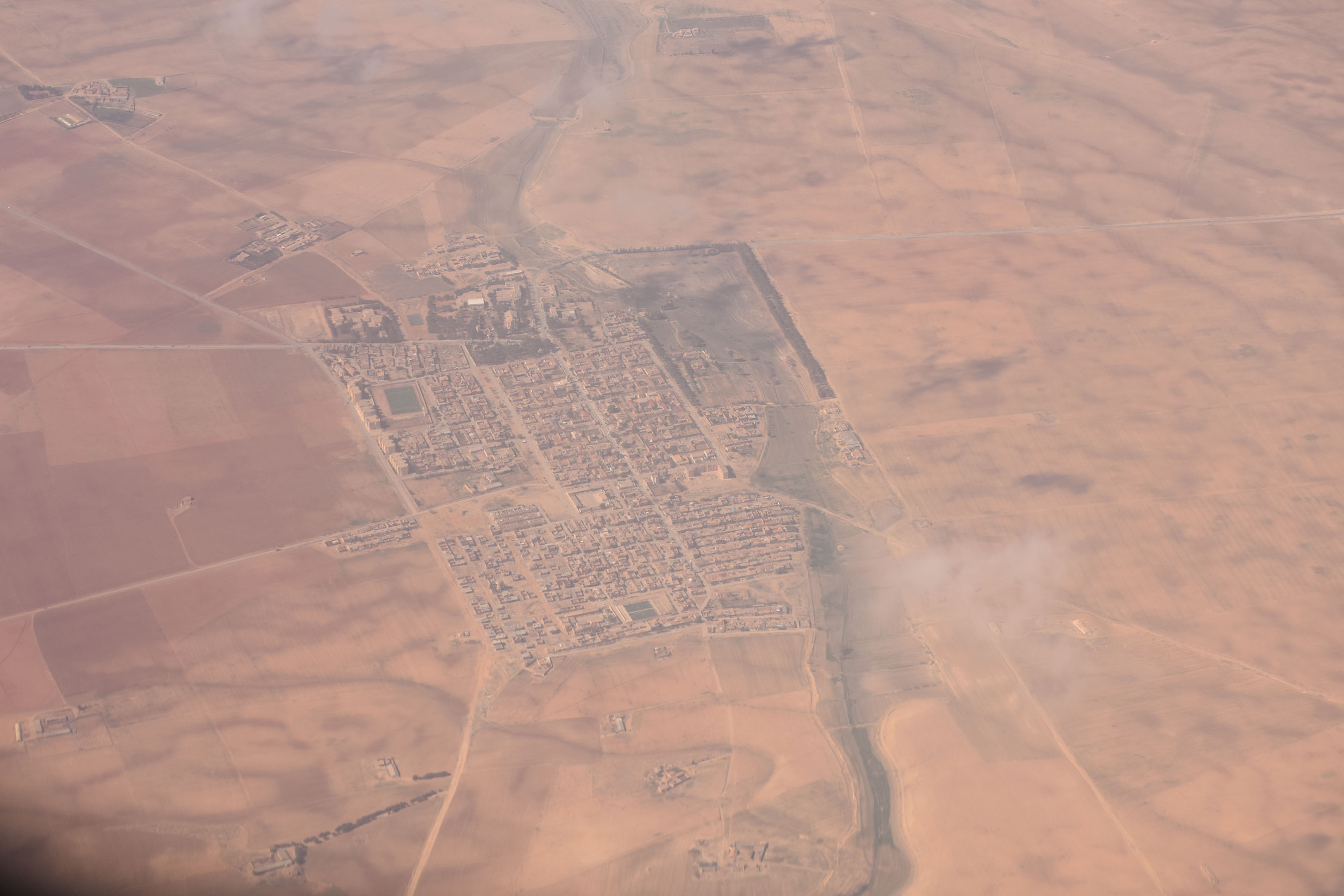
Cities and settlements of different scales came into view. In some instances all sidewalks, roads and pavement of any kind match the hue of the surrounding land. It is hard to discern materials – the buildings look like they are set on a clearing in the land. The effect is reminiscent of The Western Town: A Theory of Aggregation, a great analysis of towns in the western United States circa 1860-1890.


5/21 update: the airplane used on this flight was an ATR-72 turbo-prop airliner with a cruising altitude of 19,600ft (typical jet airliners cruise at 35,000-40,000ft). The views of the landscape offered at this relatively low altitude made all the difference, and help explain why the views over the United States appear so much more distant.
